| Maps and Overlays |
|
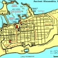 |
Alexandria
3341 × 2089, 1.9 MB |
|
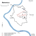 |
Amphipolis
901 × 835, 38.8 KB |
|
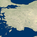 |
Ancient Anatolia
2240 × 1120, 605.7 KB |
|
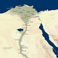 |
Ancient Egypt
For now only showing some of the more important settlements.
800 × 1760, 285.4 KB |
|
 |
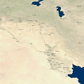
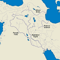
Ancient Iran
3200 × 1760, 1.2 MB |
|
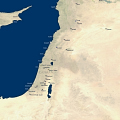 |
Ancient Levant
960 × 1600, 348.6 KB |
|
 |
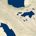
Ancient Mesopotamia
1760 × 1440, 594 KB |
|
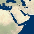 |
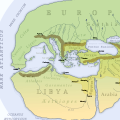
Ancient Middle East
7200 × 7200, 8.1 MB |
|
 |
Aphek
392 × 485, 30.2 KB |
|
 |
Avaris and Pi-Ramesse
602 × 769, 98 KB |
|
 |
Avaris and Pi-Ramesse (colored)
1204 × 1538, 341.7 KB |
|
 |
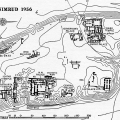
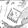
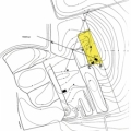
Avaris Hyksos fortress
505 × 368, 117.2 KB |
|
 |
Babylon
800 × 694, 20.9 KB |
|
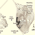 |
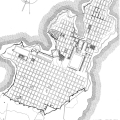
Çatalhöyük
small excavation area map
509 × 362, 57.6 KB |
|
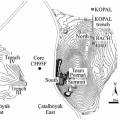 |
Çatalhöyük
509 × 362, 44.3 KB |
|
 |
Dur Sharrukin
572 × 607, 127.1 KB |
|
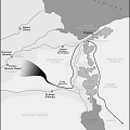 |
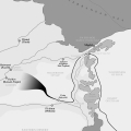
Eastern Nile Delta
Route of the Exodus from Egypt
1633 × 3500, 542.7 KB |
|
|
Egypt and the Levant
1600 × 1920, 561.8 KB |
|
 |
Ekron
497 × 387, 48.3 KB |
|
 |
Emar
645 × 468, 62.3 KB |
|
 |
Exodus
1633 × 3500, 542.7 KB |
|
 |
Hattusa
700 × 1100, 205.5 KB |
|
 |
Hazor
476 × 600, 81 KB |
|
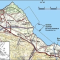 |
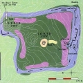
Helike area
603 × 466, 53.4 KB |
|
 |
Ilios
540 × 405, 53.5 KB |
|
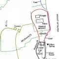 |
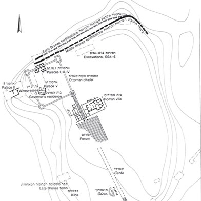
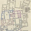
Jerusalem
city of David and Solomon
491 × 632, 83.5 KB |
|
 |
Miletos
861 × 1231, 322.5 KB |
|
 |
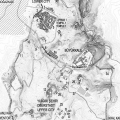
Nimrud
Kalhu
1288 × 1600, 493.3 KB |
|
 |
Nippur
666 × 670, 71.7 KB |
|
 |
Nippur
373 × 432, 181.3 KB |
|
 |
Pi-Atum
2580 × 3624, 363.1 KB |
|
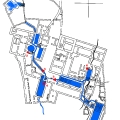 |
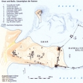
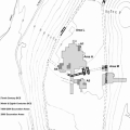
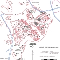
Qumran
manufactury of earthenware, no scriptorium
671 × 863, 24.8 KB |
|
 |
Rivers of Edin
400 × 400, 33.4 KB |
|
 |
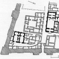
Shaduppum
554 × 534, 9 KB |
|
 |
Shaduppum
1600 × 1340, 259.7 KB |
|
 |
Sharuhen
335 × 460, 55.8 KB |
|
 |
The World according to Herodotus
Blank vectorized map.
2404 × 2074, 661.3 KB |
|
 |
Ugarit
889 × 1200, 204.6 KB |
|
 |
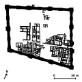
Uruk schematic map
520 × 600, 19 KB |
|